Follow the open road east to the open skylines of South Luangwa, overnight in Lilongwe, stop over in Dedza for authentic handmade pottery, cruise the coastline in Cape Maclear and take your rest and Pumulani on an epic road trip through Zambia and Malawi.
Scenic Drives from Lusaka
Emerald season is upon us. We are thrust in between the low points of hills, proudly green, defying the white sandy soil beneath them. Every now and then, turning a corner, a few bags of charcoal standing upright come into sight. A woman lies down, her eyes lazily condemning us for not stopping or for not caring enough to stop. We are still in Lusaka Province, Rufunsa District. Over the hills, somewhere lies Mozambique.
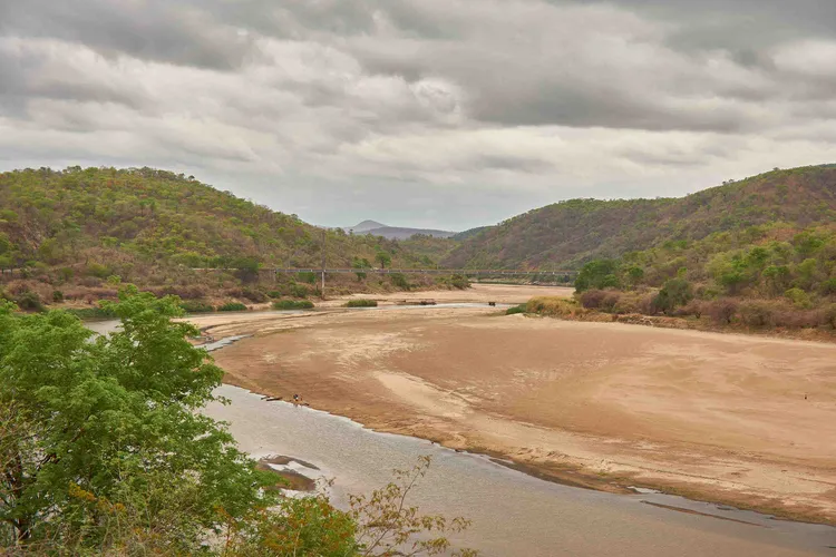
We reach the Luangwa Bridge, which hangs over the river. The 222-metre bridge looks comical, an engineering marvel of steel and wire that seems arrogant over the muddy trickle of water below it. The river will be unrecognisable in a few months, swelling until it reaches the banks – if the rains come. The sky is pregnant with swirling shades of grey and white that shield us from a jealous sun. We are waved through by the military as we cross the bridge and enter the Eastern Province. We are heading east.
The hills flatten, and the green hollows out. An endless canopy of trees is traded for smallholdings. Small towns hugging the Great East Road come in and out of sight; they erupt out of the landscape like they exist to justify their place on a map. Some are good for petrol, others for smoking breaks. Nicotine lingers in the car as we drive on.
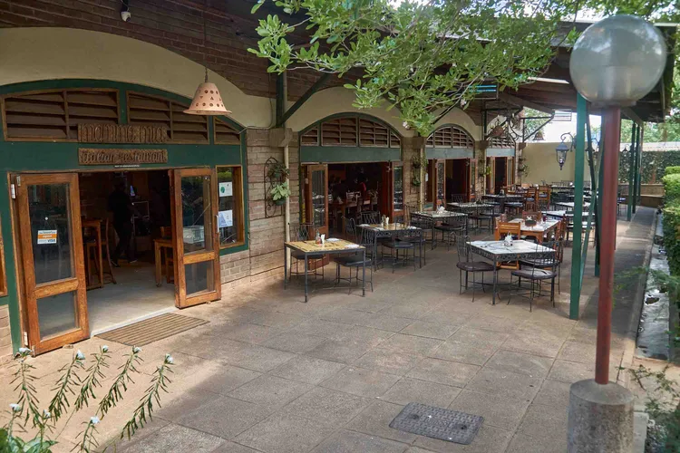
Chipata draws the countryside in, pulling towards it trucks, beat-up Corollas, and motorcycle taxis. We turn off to Mfuwe. It loosely holds the title of a tourist town, but it has few of its markings – maybe because its patrons are of the wealthier, non-small-town sort. Still, curios are found here, under the guise of environmentalism and community projects. We pass through it with little more than a passing thought.
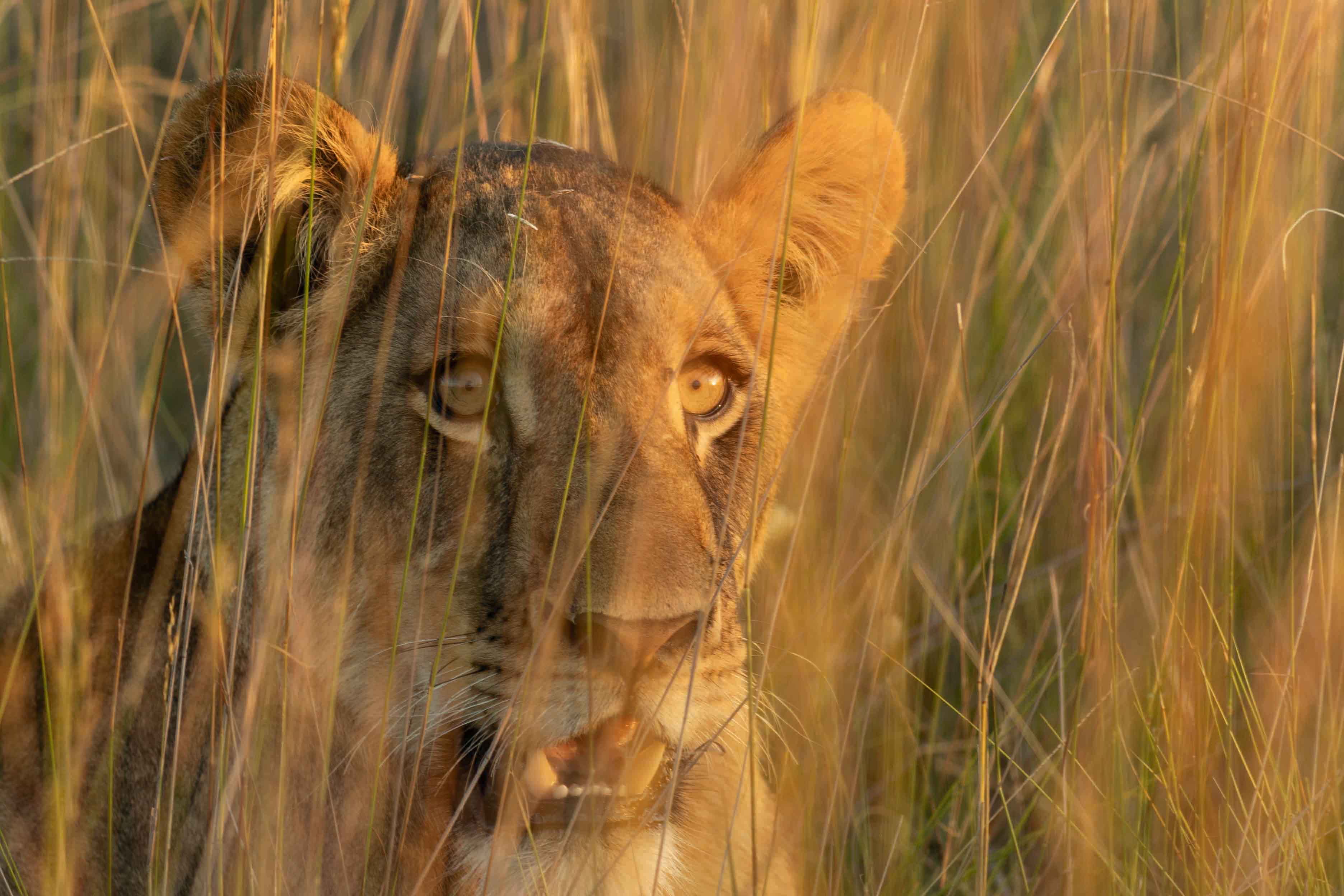
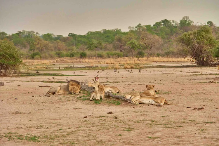
Walking Safari in South Luangwa National Park
Our first destination, Nkwali by Robin Pope Safaris, is not too far from Mfuwe town. To get there, we amble through a field of ravaged trees. Coppiced stumps rise out of the field like embers only recently put out. At first, I thought this was the result of woodcutters, but I later discovered that this used to be a field of Mopani trees, a favourite food of elephants. They acted like a band of marauders sweeping through the land, pillaging everything in their path.
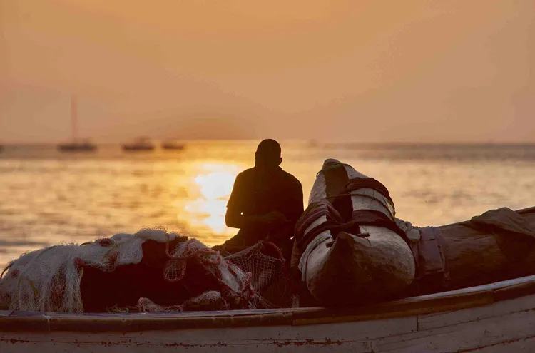
We are greeted with the usual pleasantries of the safari lodge – wet towels for our faces and men for our bags. We leave the room hurriedly and have lunch before heading out on a game drive. Because Nkwali is situated on the river facing South Luangwa National Park, we take a boat to the other side to access the safari vehicles. A small crocodile, annoyed by our arrival, shuffles into the river as we cross into the park.
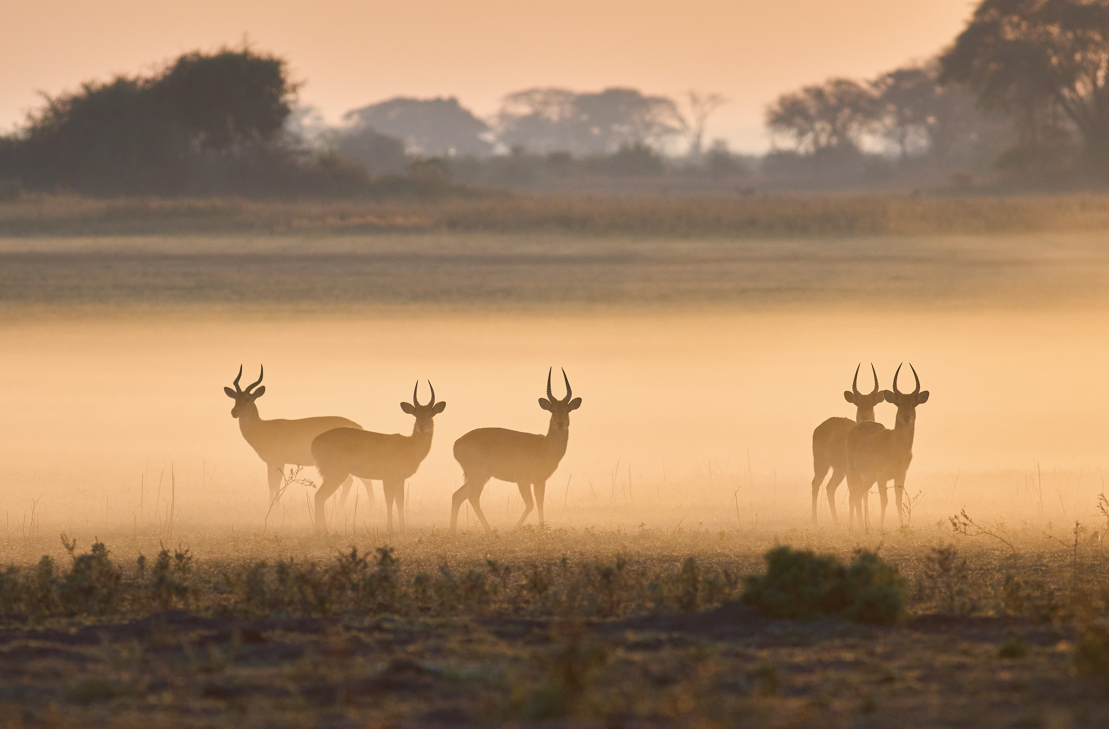
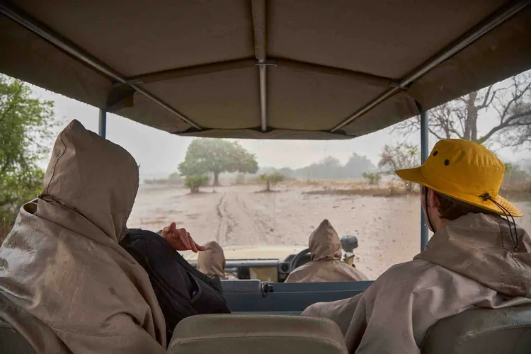
Not long afterwards, the dark clouds hanging over us break, and it pours. The rain comes at us sideways, and nothing is spared – neither human nor camera. Baboons and impalas form an unholy alliance by hiding together under a clump of trees. The only bucks brave enough to stand in the rain are waterbucks. But it is tough to see them, our squinting eyes stung by the relentless rain.
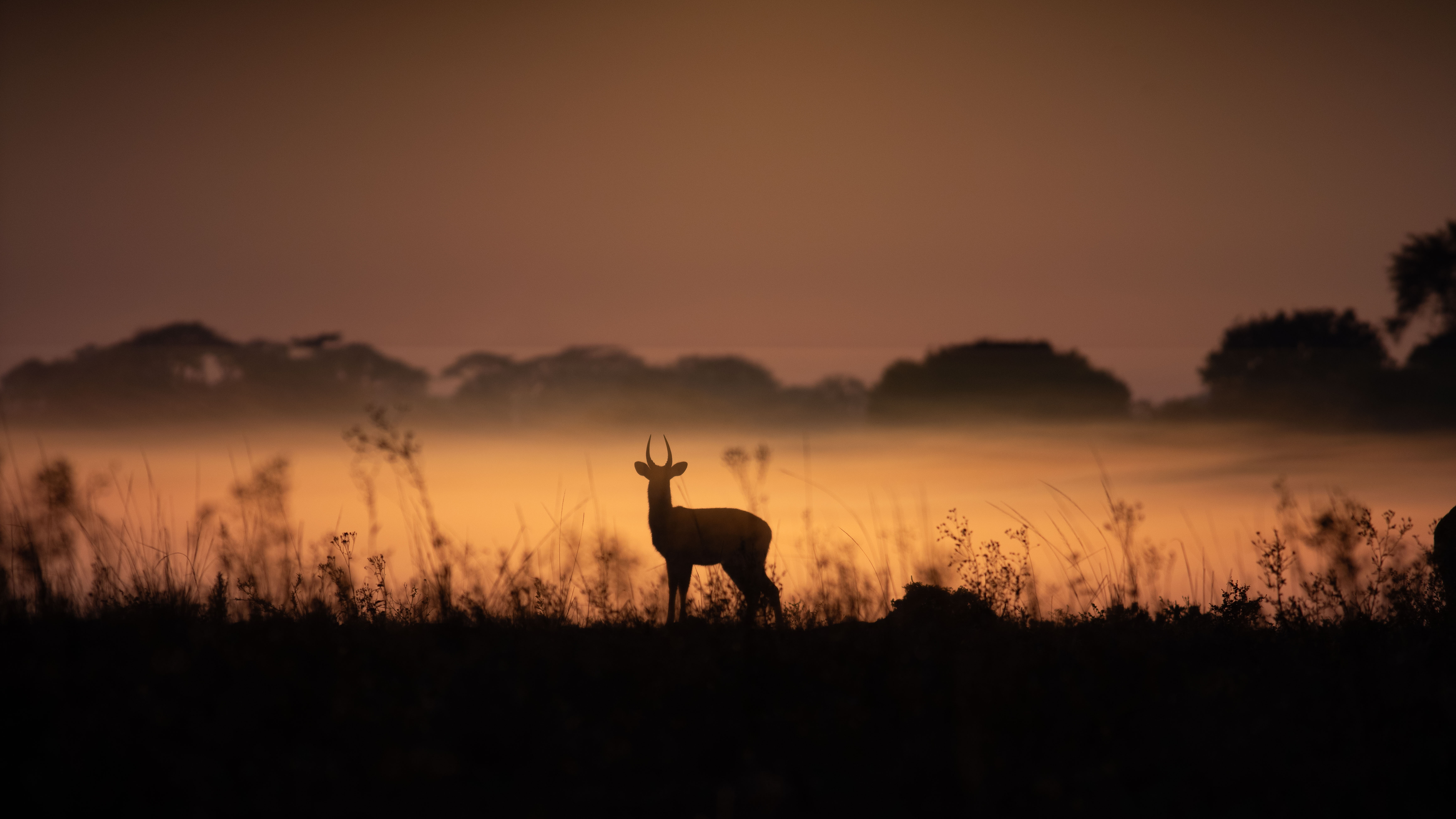
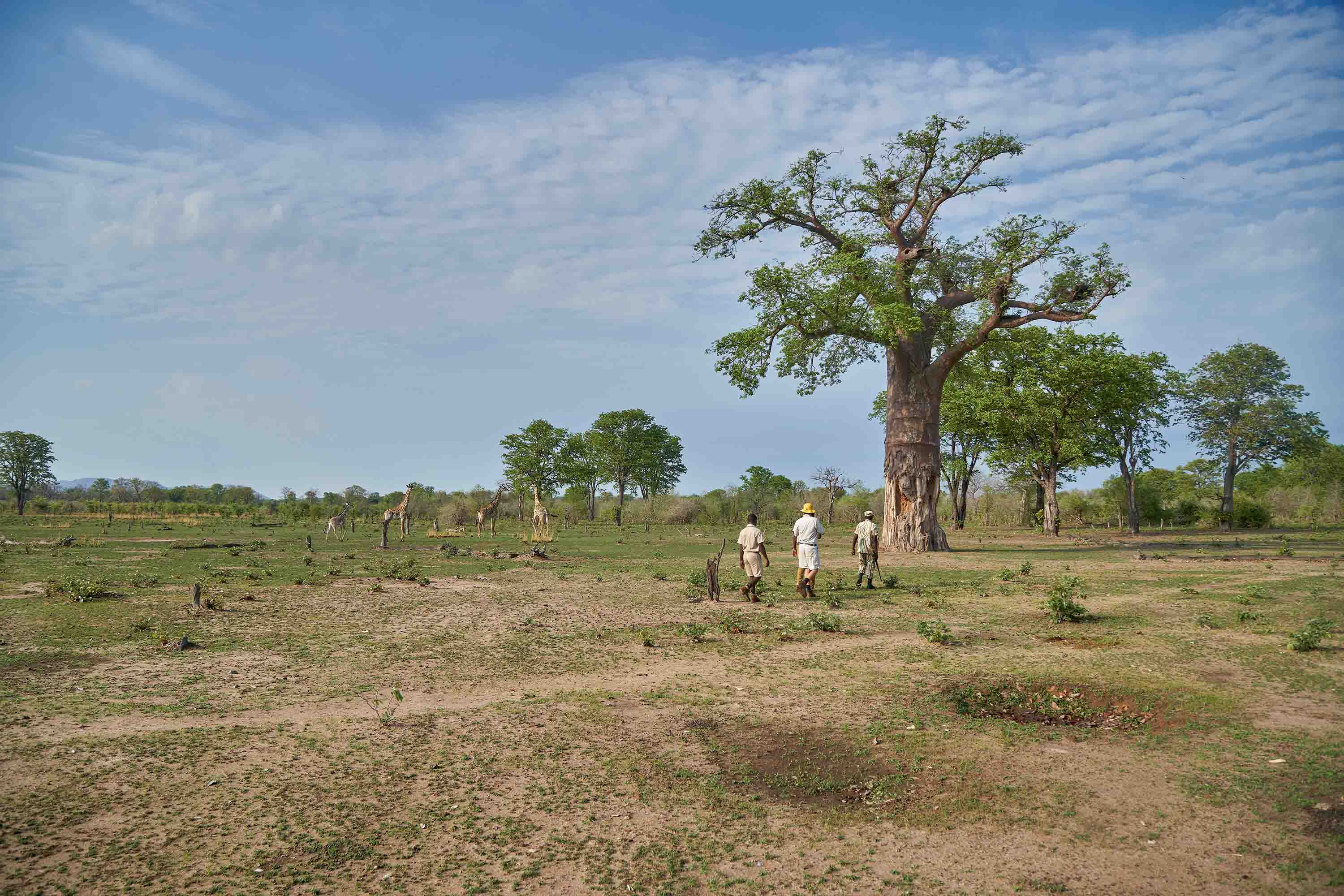
As the rain clears and lightning elsewhere paints a backdrop to the landscape, we see Thornicroft’s giraffes, endemic to South Luangwa, grazing on the freshly moistened grass. Their preservation was one of the factors that drove the national park’s creation, spearheaded by the British conservationist Norman Carr. He was also the one who first developed the walking safari – the conservationist’s answer to hunting. We went on a walking safari the following day after an early night.

If the rains disperse game across the park, away from the areas of water still intact during the dry season, they simultaneously bring forth an abundance of small things. On our safari walk, apart from spotting the tracks of elephants and bucks, the ground is littered with little mites, some a fiery red like the sun that had cleared away the clouds. The cicadas are deafening. We are taught how to catch and eat them.
We depart for Luangwa River Camp. Here, we enter the national park and, at some point, cross the river by car. It is still shallow enough for the 4x4 mammoth to pass through easily. The riverbed is mostly visible to us, as are the tracks of elephants and hippos.
Exploring Malawi
We watch as elephants cross the sands of the dry riverbed and drink water from the river. Soon after our sighting, we leave for Malawi. It is not more than half an hour from Chipata to the border. On the slip road approaching the border post, a few men wave us down with notes in their hands. They want to exchange dollars for their wads of Malawian Kwacha. There is a foreign exchange crisis in the country, so not only is the black market rate much better than the official rate but there is also a severe fuel shortage in the country. We have four jerry cans on the car’s roof; by the end of the trip, they have all been used.
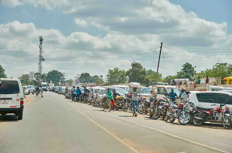
The border post is new and was opened by the current presidents of Zambia and Malawi. A plaque commemorates the occasion, etching their two names into history. But for all its poorly designed grandeur, few vehicles are passing to and fro. This may be a result of the fuel crisis or, more likely, a consequence of a relatively inconsequential border crossing. Both Malawi and Zambia are landlocked countries, relying on their better-placed neighbours on the seaside for vital trade.
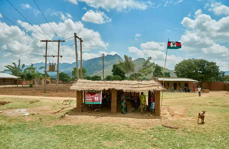
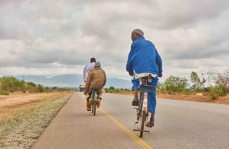
We see few cars on the road throughout Malawi, but the streets are busy. As soon as we leave the border post, we are met by scores of people on the side of the road. Malawi has the same population as Zambia but is less than a sixth of its size if you don’t factor in the lake. All this means that people on foot and bicycles spill out onto the road, unable to go anywhere else. So do the goats, who have a wanton disregard for their own lives.
The road from the border to Lilongwe is straight and pleasant. There are many roadblocks, at times seemingly more frequent than cars. Alongside the road, smallholdings stretch out into the horizon. Most have rows of maize planted, awaiting rain. Cowboys, forlorn in the bright sun, herd cattle.
Villages are also more numerous in Malawi. We chance to inspect them in greater detail as we slowly wrangle our way to the capital, hoping to conserve fuel. In some towns, mosques replace churches, and spires of black smoke locate the local brick kilns. Outside of mango trees, which provide shade in the dry fields, clay bricks seem to be a national obsession. The most diminutive dwelling, the most inconsequential wall, is made with red clay bricks.
Lively Lilongwe
Eventually, we amble into Lilongwe, in the middle of the country’s central plateau. Broad, newly built highways take us from the edge of town to ‘Area 10’, where we will be staying the night. Network providers, donor countries, and the president all compete for billboard space. But this cannot distract us from the fact that Lilongwe is a strangely laid-out city. It is an artificial capital resulting from a deliberate government policy to relocate its headquarters immediately after independence. And so, it lacks any organic unity in its makeup. Areas seem only accessible by road. But this may also be a result of our road-bound travels. Neighbourhoods are known as ‘Area’ followed by a number. Undeveloped land – earmarked for future government buildings – arrests development. The government buildings remind me of the aluminium-clad structures gracing Lusaka.
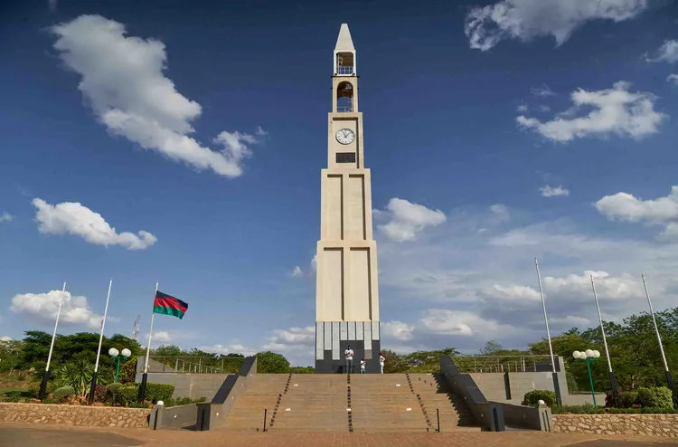
We did not stay long in the cottage, having found our way to a restaurant for lunch and some sense of the city. We went to the World War I Memorial in the government district. It looks like a fifty-metre-tall clock tower, with four large clocks looking out over the city. In front of it, there is a statue of Kamuzu Banda, Malawi’s independence leader. We passed him and approached the clock tower. A fast-talking guide attempting the impossible task of relating the entire history of Malawi’s armed conflicts explains its significance. We ask him if we can go to the top of the tower. Of course, we may, and he leads us to the top. Vertigo sets in. The clocks have the wrong time.
That night, we went to ‘Four Seasons’, where there is a jazz night every Sunday. Lilongwe seems small. Everyone pretends to know one another, if not by actively greeting one another, then by the kind of comfort that a familiar glance affords. The music stayed on until after we left a few hours later.

Enroute to Lake Malawi
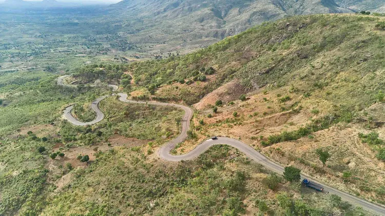
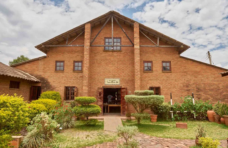
We headed off to Lake Malawi. From the plateau, we climbed further, the scenery becoming more majestic with every bend in the road. The most memorable town was Dedza, shrouded in mist and mystery as we passed through it before descending the escarpment. Here, we stopped at their well-known pottery centre and had lunch. We bought some mugs as gifts.
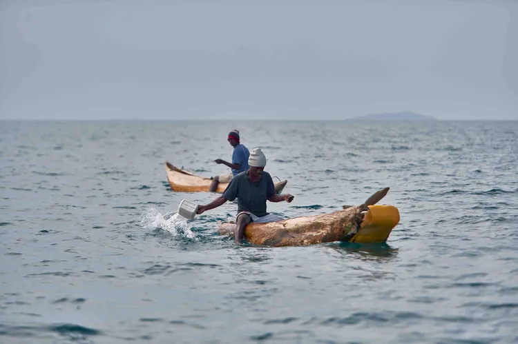
After Dedza, we descended the escarpment. Most of the roads we used are good, and this one was no different. From there, it is not too far to Cape Maclear, a fishing town on a peninsula that juts out of the southern part of Lake Malawi. We had to burrow our way from the edge of the town until we reached the lakeside. Nestled in between some houses and other lodges is Mgoza Lodge. It is charmingly rustic. Crudely constructed wooden furniture breaches the boundary between the lake’s sand and the lodge’s grass. A chicken walks on the beachfront.
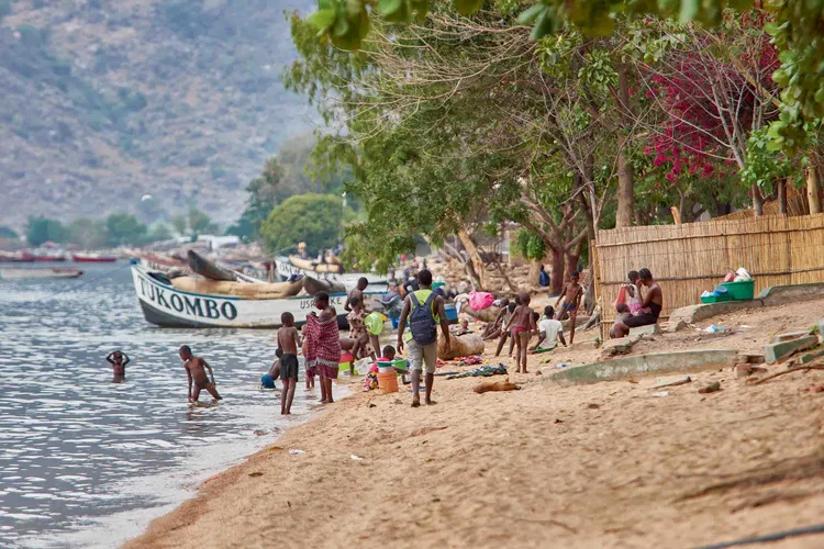
This afternoon, we lounged around and took a walk along the beach. Newly constructed lodges flirt with the fishermen’s houses crumbling next door because of neglect, water erosion from the lake, or both. When we returned, many people were preparing themselves for dinner. A young group of Spanish-speaking tourists climbed off a boat, a German missionary couple made conversation with me, and I had lake fish for dinner. Mgoza seems to be a favourite amongst those who come to Cape Maclear. It certainly feels the most democratic of our accommodation, with nothing alike between the tourists but the lake.
Resting at Pumulani
Pumulani, our final destination, was not too far from the fishing village, but parts of the road were unfriendly. Situated in Lake Malawi National Park, a UNESCO World Heritage Site, Pumulani looks over the lake, perched on a cliff. Each chalet, separated from one another by walkways, has its own private view of the lake.
There are things to keep one busy on the lake, but it can also take the rhythm of a beach holiday. We spent two nights here, and apart from lounging by the pool, we hiked, kayaked, and snorkelled.
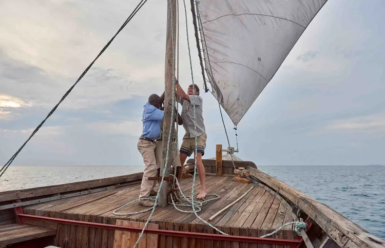
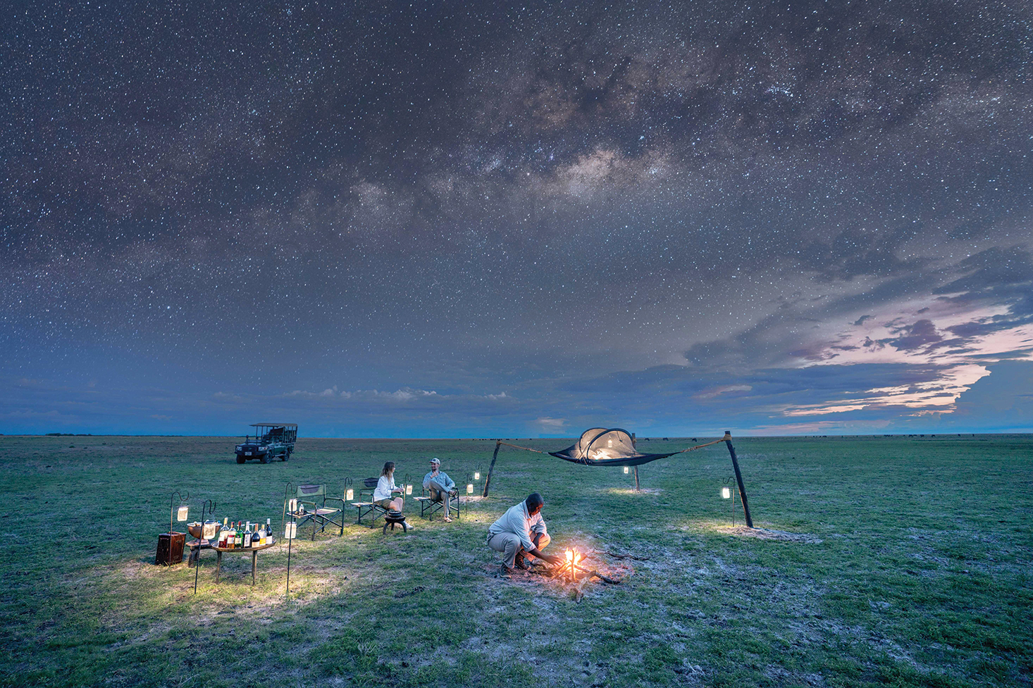
On our final evening, we went on a sunset cruise on a large dhow. We used the motor to take us into deep waters. But now the dhow was drifting across the lake, lilting us to the sombre realisation that our holiday was nearly over. A soft wind took us away from the sun. It was too cold to attempt a swim, but we all flirted with the idea anyway. After our cruise, we were invited to look at the stars through the telescope. The moon was relatively full, and there were clouds out, but we could still quite clearly see the rings of Saturn. A few specks of the cosmos were still visible. They were just beginning to dance to life. Tomorrow morning, we leave early, stopping rarely and probably only to admire a view for the last time, buy mangoes, or cross the border. We will be heading west, and the sun will certainly be bright and full.
How to get to Pumulani from Lusaka
- Day 1 : Drive from Lusaka via Great North Road to South Luangwa National Park and spend the first night at Nkwali by Robin Pope Safaris and explore SLNP by foot on a walking safari
- Day 2: Drive to Luangwa River Camp by Robin Pope Safaris and go on a game drive to sight giraffes, elephants and hippos.
- Day 3: Drive from South Luangwa to Lilongwe and book an Airbnb in Area 10. Consider visiting the Four Seasons on a Sunday night, where you may be treated to jazz music.
- Day 4: Drive to Lake Malawi and make sure to stop in Dedza for some clay souvenirs. After enjoying the beautiful views, stay at Mgoza Lodge.
- Day 5: Finally, drive to the fabulous Pumulani by Robin Pope Safaris. Treat yourself to various activities, from simply lounging by the lake to hiking, kayaking and enjoying a dip to snorkel in the clear waters.